The Secret Speer Neighborhood Shares Up Great History on this Urban Hike
Shhh! Here’s the funny thing about Speer Neighborhood. It’s the neighborhood with the most millennials in Denver (42% of the neighborhood’s population is between 25-34!), yet lots of folks don’t know they live here in Speer Neighborhood. But if you say Alamo Placita or West Wash Park, everyone says ah-ha! Problem is, according to the City of Denver, “Alamo Placita” and “West Wash Park” don’t exist as neighborhoods. But Speer does. That’s a funny thing living in one of the most convenient neighborhoods in Denver, yet no one knows where it is.
In the Middle of Everything, Almost
The Speer Neighborhood’s boundaries lie just south of Cap Hill and Cheesman Neighborhoods, east of Baker Neighborhhood and north of Wash Park Neighborhood. Officially, the boundaries are Seventh Avenue to the north, Downing Street to the east, Alameda Avenue to the south, and Broadway to the west. Yet person after person, when walking in the neighborhood and when asked where they lived, not one person said, “Speer.”
Save up to 30% on New Deals from Brands You Love on REI.com. Hurry, limited time. End dates vary.
Grandiose Homes and Fantastical Parks!
Funny how the neighborhood named after a Mayor who had some of the biggest impact on Denver is practically anonymous. Mayor Speer, who lived in a now-torn-down home in the Alamo Placita community and who developed the area along with creating the City Beautiful movement which brought the large boulevards, City Park, Civic Park, and many other landmarks Denverites love, would have probably been a bit embarrassed that no one knows where his namesake is. He certainly was a showman, and the homes in the neighborhood showcase his grandiose-ness as well.
Dancing Elks and Bicycling Ladies
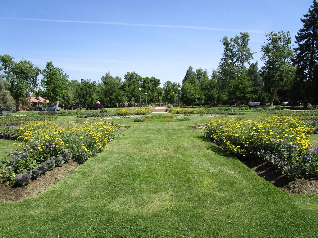
Loaded with historical parks, Speer Neighborhood can’t be missed. You’ll start the walk at the historic Alamo Placita Park. This gorgeous little park and garden has a long and fun history. It started as Chutes Park, where Denverites could watch a herd of elk dive off a platform, followed by a female bicyclist from Paris. They then could gawk at Henri Maurice Cannon, a 617 pound performer, plop off the platform too. Next, they could marvel at the recreation of the Last Day of Pompeii volcanic disaster, recreated with a “real” volcano.
Sadly Chutes Park burned to the ground and went bankrupt. The area was renamed Arlington Park. Mayor Speer, who owned land in and around this area, decided the area was “overgrown with mammoth cottonwoods”, cleared it and cut the park into lots for development. Right before he left office, the city purchased portions of the land and declared it a public park for the citizens of Denver. Cherry Creek ran through the center of this contested area, of which Mayor Speer ultimately had channeled and walled. The north side became known as Alamo Placita Park, and the southside is now Hungarian Freedom Park.
Revolution and Lion Heads!
While in the park, be sure to enjoy the formal gardens, which bloom nicely in the spring and summer. Then, you’ll want to cross Speer Blvd and visit Arlington’s other half, Hungarian Freedom Park. Like its sister park across Speer Blvd, Alamo Placita, this park has a long history. It started as a dump, became Arlington Park under the vision of SR DeBoer, and ultimately was renamed to commemorate the 1956 revolt of Hungarians against Soviet oppression. DeBoer originally designed the park to offer a forested respite for the local neighborhoods, and you can still see the pine, spruce, fir, honey locust and hawthorn at its southeast end.
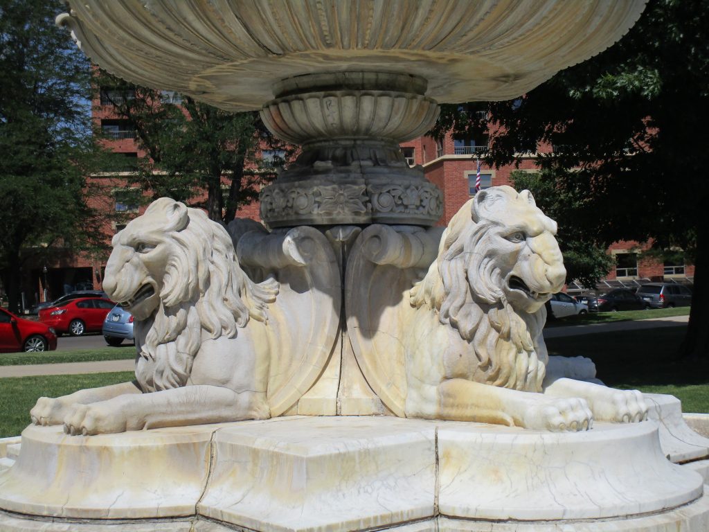
Since the original design, in 1963, the Hungarian Club of Colorado, led by Janos Benko, petitioned the city to create a memorial to honor the people killed in the Hungarian/Soviet conflict. The city agreed. The club hired Zoltán Popovits to design the Hungarian memorial, the first of its kind in North America. In 1976, a Baroque two-tiered caste with lion heads, copying the one in Benedict Park and designed by Maurice Bardin, moved in. In 1986, the Hungarian Freedom Park was listed in the National Register of Historic Places as a contributing feature of the Denver Park and Parkway System.
Walk this Way
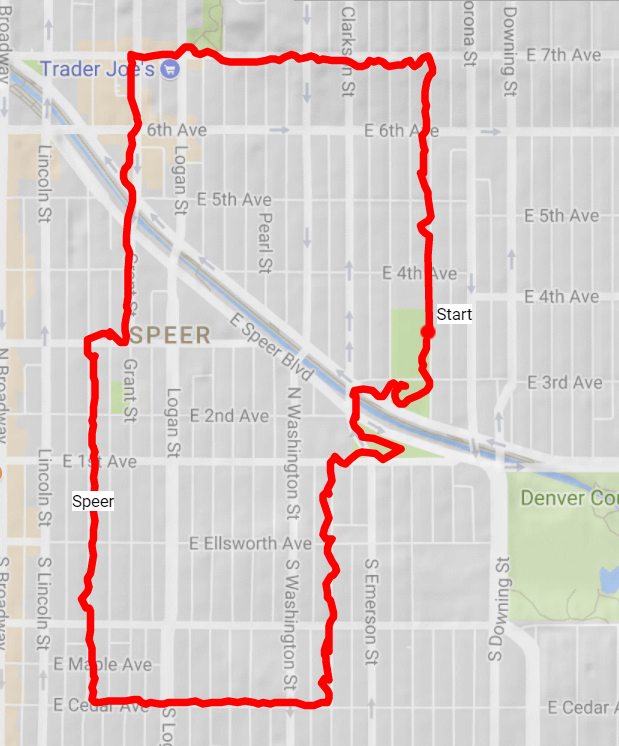
This wonderful neighborhood filled with homes from 1890-1930s or so and split in half by Speer Boulevard and the Cherry Creek, has wonderful community, convenience and connected-ness to downtown. It made for a great walk, too, despite having to brave the crossing of Logan and Speer to complete this 3.4 mile route.
The route (click for interactive map):
Start at Alamo Placita park; a good address to locate it is 354 N Ogden St. Walk north to E 7th Ave, taking a left.
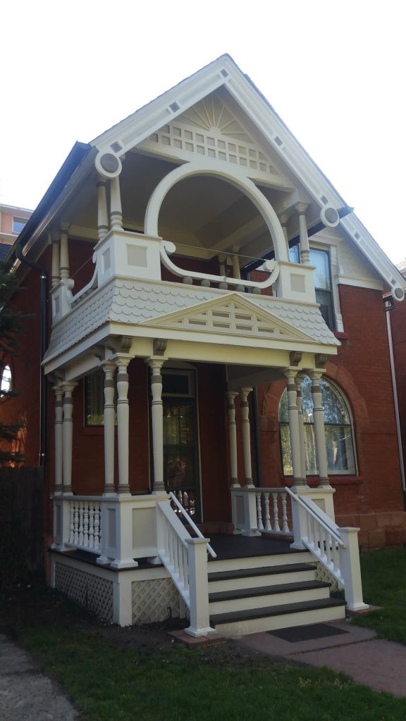
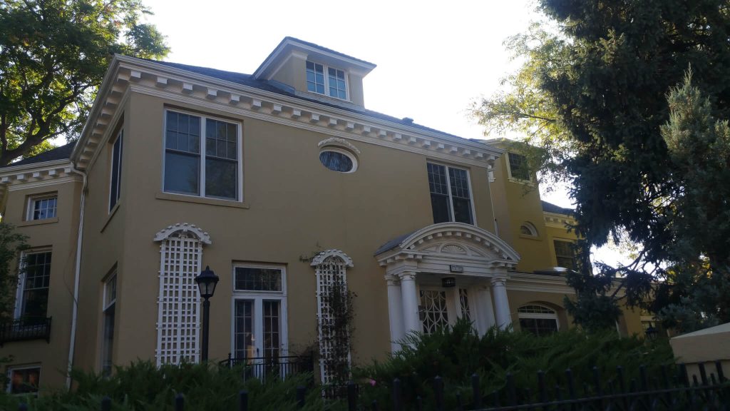
You’ll be walking on the border of Speer and Cap Hill neighborhoods with large homes on both sides of the street. At Grant St, take a left.
Cross Speer, getting a nice look at Cherry Creek and the Cherry Creek trail. At E 3rd Ave, take a right, then take a left on Sherman.
Continue down Sherman. Just north of 1st on the east side of the street hangs a wonderful tea-bag curtain as a piece of art in a window. Keep going south to E Cedar Ave, take a left.
You’ll be walking in the Historic Grant Street District. Take a left on Clarkson.
At 1st St, take a right and then a left on Emerson. Take a moment and view the memorial to the 1965 Hungarian uprising in Hungarian Freedom Park which commemorates the 1956 revolt of Hungarians against Soviet oppression. The lion fountain, designed in 1932 by Maurice Bardin, was placed in the park in 1976.
After enjoying the park, continue north across Speer one more time, then take an immediate right on E 3rd Ave. When you reach Alamo Placita park, enjoy the gardens on the south side of 3rd, which still honor the original layout designed by Saco Resnik DeBoer.
Take a left on Ogden, returning you back to the start.
What did you like about this walk? Post it on Facebook and tag your posts with #denverbyfoot so I can find them.
See you on the trail!
~Chris


Trackbacks/Pingbacks