
Five Great Denver Hikes without a Car

You might see bison on the First Creek at DEN trail!
The mountains are calling; but you can’t get there. No worries. Great hikes within Denver just wait for you to jump on them and enjoy the mountains from afar. Here are 5 super hikes in Denver you can access via transit with directions to getting to the trail heads. (You can also get there by car!)
1. First Creek at DEN Open Space
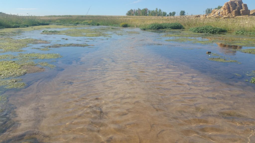
The First Creek is a refreshing sight!
This amazing trail at the corner of 56th Ave and Peña goes two directions. When you approach the trailhead, you can go east on a concrete path for two miles and then return for a total of 4 miles. You’ll meander along First Creek, under the A Train, and out to the edge of Aurora. Watch for owls, coyotes, and prairie dogs. Or, if you go west, you’ll go into the Rocky Mountain Arsenal Wildlife Refuge. The dirt trail starts along the First Creek and then veers north to the bison overlook. Watch for bison, deer, hawks and eagles for 4 miles roundtrip. If you do both sides, both ways, you’ll hike 8 miles. For a trail report, see this article.
Get there: Bus 45 is your ticket to ride. You can pick it up for the Central Park Station. Take it to 53rd and Kittredge stop. From there, you’ll have about a 20 minute walk to the trailhead. Head east on E 53rd toward Kittredge. Turn left on Memphis St. Turn right on E 56th Ave. Turn left on Buckley Rd. into the parking lot where you’ll see signs telling you the story off the prairie dogs. Continue north on Buckley Rd for 1/3 mile to get to the trailhead to go east or just a bit further to get to the trailhead that goes west. Be sure to bring water, snacks, sunscreen, etc. There are no facilities here.
2. The Norfolk Glen Loop

The Norfolk Glen Loop in Aurora combines the best of the outdoors with the ease of two great trails, the Sand Creek Greenway and the High Line Canal Trail. At five miles, which you can shorten to just over three, this hike starts at the Star K Ranch Morrison Nature Center off Smith Road (16002 E. Smith Road, Aurora 80011). You walk through wonderful open space filled with deer, elk, coyotes and prairie dogs. You’ll cross the Sand Creek onto the High Line Canal Trail, and walk for a couple of miles with the Canal on your right and open space full of hawks and eagles on your left. After navigating the Triple Creek Trailhead, you’ll head back along the Sand Creek and its Greenway on soft surface trail. When you arrive back to the Nature Center, be sure to go inside to use the restrooms and enjoy the interpretive history about Mr Stark. For the kids, they can touch some animal furs, too! See a map of the walk here: Norfolk Glen Loop. This walk is also in The Best Urban Hikes: Denver.
Get there: Bus 37 is your ticket to ride. You can pick it up from the Peoria A Train Station. Take it to the 32nd Ave and Chambers stop. From there, you have about a 20 minute walk to the trailhead within Star K Ranch. Head west on 32nd Ave to Chambers. Turn left on Chambers Rd. Turn left on E Smith Rd. Turn right on Laredo St. Follow the signs to the Morrison Nature Center. Bring water, snacks, sunscreen, etc. There are restroom facilities here. If you have time, be sure to enter the Morrison Nature Center and check out the animal and natural history displays.
3. The Confluence Loop
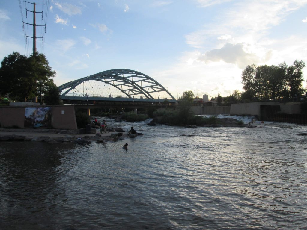
Connecting with the Platte is a rich opportunity.
A great hike for locals wanting to show off Denver, this hike starts at REI at Confluence Park. You’ll walk along the Platte River toward Mile High Stadium, cross the million-dollar bridge, then enjoy the swoosh of Elitch’s roller coasters. Pass the City of Denver’s Centennial Garden, then you’ll take a right and amble along Cherry Creek. Here, you can see where Denver and Auraria were founded while enjoying some great urban art. The walk continues along the Platte River to Denver’s Skatepark, which is continually ranked in the top 10 free skate parks in the world. When you’re finished, walk the Millennial Bridge back to Union Station for lunch. For a map of the walk, click The Confluence Loop.
Get there: A great place to start this hike is from the REI Flagship store where you can gear up and snack up. To get to REI, Union Station is your ticket to ride. From there, you have about a 15-minute walk. Out of Union Station, go southwest on Wynkoop St toward 16th St Mall. Turn right on 15th St. After crossing the Platte River, spy a sidewalk to take a left to the Platte River Trail. You’ll walk along the river next to the rear of REI. The trailhead starts at the Starbucks at REI.
4. The Sand Creek Greenway
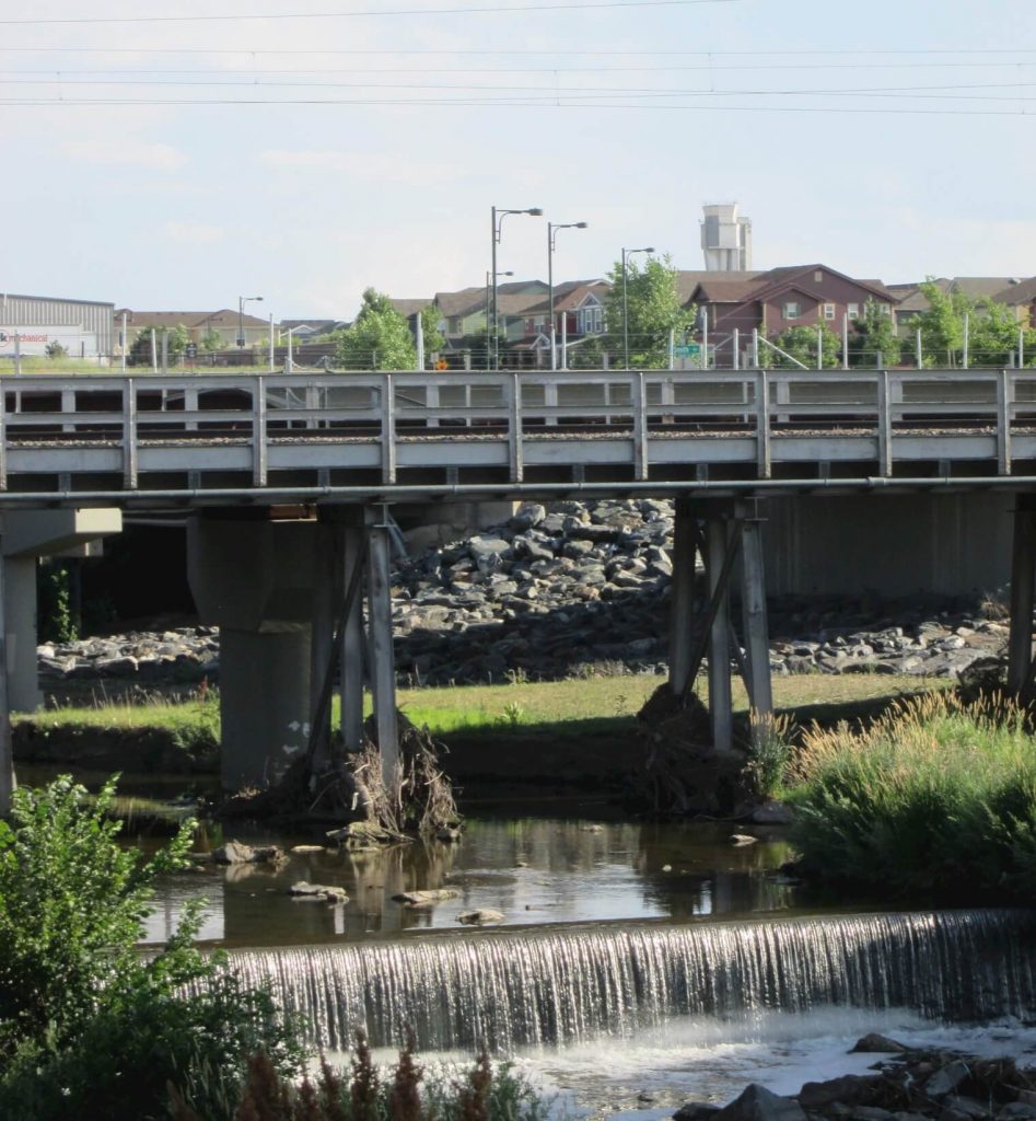
For a little bit different adventure, walk the Sand Creek Greenway between the Central Park Station and the Dahlia Street Trailhead. You’ll wander along the Sand Creek, under two major interstates, past a waterfall, and along a quiet greenway where you won’t ever hear or see I270 right next to you. It’s a good contemplative walk or even a place to catch some invertebrates in the water. Be sure to bring binoculars to spy the bird life in the reeds and along the creek bank for this 4-mile wilderness hike in the city.
Get there: The A Train is your ticket to ride. Take it to the Central Park Station. From there you have about a 5-minute walk to the trailhead. Walk east along the sidewalk that parallels the train tracks. You’ll cross the old Smith Road bridge that is closed to car traffic. At the east end of the bridge, follow the footpath down the bank. When you reach the concrete tail at the bottom of the footpath, you’ll be on the Sand Creek Greenway. The trailhead starts here and immediately goes north, then west, under the train tracks. Bring water, snacks, sunscreen, etc. There are no facilities here. There is a restroom about halfway at the Commerce City Wetland Park. At the Dahlia St. trailhead, you can catch bus 40 which is a 4-minute walk to the Eurdora St and 56t St Station.
5. Sloan’s Lake Loop
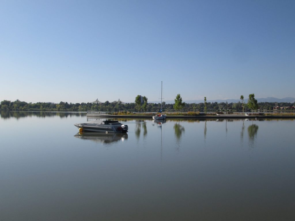
If you’re needing a bit of a water view with a mountain backdrop, do a 3-mile lap around Sloan’s Lake. This active trail filled with skaters, striders, walkers, and families provides plenty off places to rest in the shade on benches. Gardens and art dot the loop. You might even catch an outdoor exercise class or a dragon boat race!
Get there: Bus 28 is your ticket to ride. From the station, you’ll have about a 6-minute walk. Take the bus to the W 26th Ave and Vrain St station. Head west on W 26th toward Winona Ct. Turn left onto W Byron Pl. and follow to the lake. Walk in either direction around the lake to make a loop. Bring water, snacks, sunscreen, etc. There are plenty of restrooms around the lake. You may also want to venture into the neighborhood and enjoy this walk.
For more hikes in Denver you can do without a car, check out over 20 of them in my book The Best Urban Hikes: Denver. You’ll find complete maps and directions for enjoying these urban treasures. Or, if you’d like to get an intensive city experience and enjoy wildlife of the human kind, get my book Walking Denver’s Neighborhoods, where you’ll find 78 3-mile loops within Denver’s neighborhoods.