
 The “East” includes the parks east of Downing St, south of 26th Ave, west of Quebec and north of Belleview Ave. Think City Park, Cheesman Park, and parts of Park Hill.
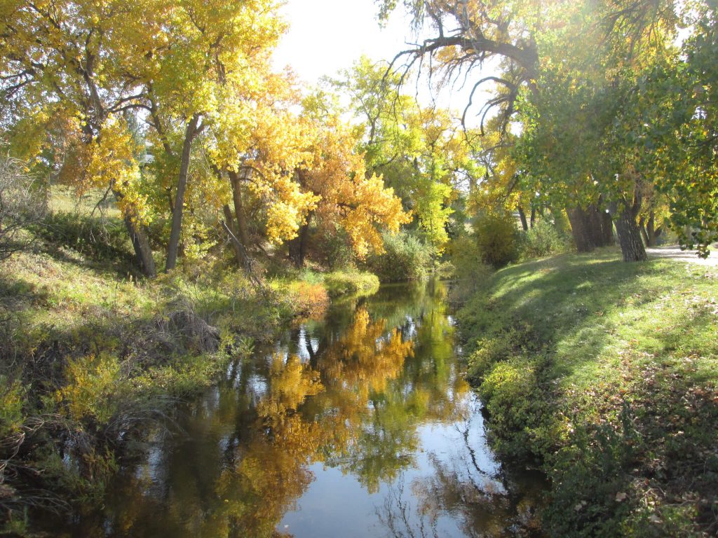
Check out the posts below to learn more about these Denver parks.
Alamo Placita Park
See video.
Location: 300 N Emerson St, Denver
Acreage: 4.6
Amenities: Benches, drinking fountain, picnic tables, playground, basketball court, flower beds, picnic area
Getting there
By car Take I-25 to Speer Blvd. Go south to N. Clarkson St. Take a left. Turn right on E. 3rd Ave. to Park. Take Cherry Creek Trail to N. Emerson St. Go north to the park.
By transit Buses 6, 12, and 83 D/L stop nearby.
By bike : Take the Cherry Creek Trail to N Emerson St to park.
Ash Grove Park
See video.
Location: 1701 S. Holly St., Denver
Acreage: 7.3
Amenities: Benches, picnic tables, playground, basketball court, soccer field, bike/pedestrian path
Getting there
By car Take I-25 to E. Evans Ave. Go east to S. Holly St. Turn left to the park.
By transit Bus 65 stops nearby.
By bike Take the Cherry Creek Trail to Holly. Go south to the park.
Babi-Yar Park
See video.
Location: 10451 E. Yale Ave., Denver
Acreage: 25.2
Amenities: Benches, fountain, memorial/monument, natural areas, bike/pedestrian path, parking lot
Getting there
By car Take I-25 to E. Hampden Ave. Go east to E. Yale Ave. Go left to the park.
By transit Buses 83D and 83L stop nearby.
By bike Take Cherry Creek Trail to S. Elmira St. Turn right on E. Yale Ave. to the park.
Bible (James A) Park
See video.
Location: 6802 E. Yale Ave., Denver
Acreage: 66
Amenities: Benches, drinking fountain, picnic tables, playground, restroom, baseball/softball field complex, basketball court, tennis court, bike/pedestrian path, High Line Canal Trail, fitness zone, football field, natural areas, picnic area
Getting there
By car Take I-25 to Yale. Go east to the park.
By transit Bus 27 stops nearby.
By bike Take the High Line Canal to the park.
Burns (DC) Park
See video.
Location: 250 S. Colorado Blvd., Denver
Acreage: 12
Amenities: Picnic tables, public art, passive open space
Getting there
By car Take I-25 to Colorado Blvd. Go north to the park.
By transit Buses 1, 3, 40, and 83L stop nearby.
By bike Take Cherry Creek Trail to S. Steele St. Continue onto Cherry Creek N. Dr. Slight left onto E. Alameda Ave. Turn left onto S. Colorado Blvd. to the park.
Cheesman Park
See video.
Location: 1599 E. 8th Ave., Denver
Acreage: 80.7
Amenities: Benches, drinking fountain, pavilion, picnic tables, playground, flower beds, fountain, walking/jogging path, bike/pedestrian path, shelter, scenic views, picnic area
Getting there
By car Take I-25 to E. 6th Ave. to Josephine St. Turn north to the park. Park in the garage.
By transit Buses 6 and 24 stop nearby.
By bike Take the Cherry Creek Trail. Turn left toward Gilpin St. Slight right onto Gilpin St. Turn right onto E. 4th Ave. Turn left onto Williams St. Turn right onto E. 7th Ave./E. 7th Ave. Pkwy. Turn left onto Josephine St. Bike racks are on York.
Cherry Creek State Park
See video.
Location: 4201 S. Parker Rd., Aurora
Acreage: 4,200
Amenities: Boating, camping, fishing, hiking, swimming, sailing, remote control field, gun range, biking, open space, dog park, picnicking, horseback riding
Getting there
By car Take I-225 to S. Parker Rd. Drive south. Turn right on E. Leigh Ave. to enter the park.
By transit Bus 83L and light rails H and R stop nearby.
By bike Take Cherry Creek Trail to the park.
City of Chennai Park
See video.
Location: 1600 S. Quebec St., Denver
Acreage: 7.7
Amenities: Benches, bike/pedestrian path, natural areas
Getting there
By car Take I-25 to E. Evans Ave. Turn west to Quebec. Go north to the park.
By transit Buses 21, 73, and 83D stop nearby.
By bike Take the Cherry Creek Trail to Quebec St. Go north to the park.
City of Karmiel
See video.
Location: 3300 E. Cherry Creek North Dr., Denver
Acreage: 3.3
Amenities: Benches, bike/pedestrian path, Cherry Creek Trail
Getting there
By car Take Colorado Blvd. to Cherry Creek N. Dr.
By transit Buses 40 and 83D stop nearby.
By bike Take the Cherry Creek Trail to the park.
City of Potenza Park
See video.
Location: 1101 S. Holly St., Denver
Acreage: 4.5
Amenities: Benches, playground, bike/pedestrian path, bocce ball court
Getting there
By car Take I-25 to E. Evans Ave. Go east to Holly St. Turn left to the park.
By transit Buses 11, 40, and 83D stop nearby.
By bike Take the Cherry Creek Trail to the park.
City of Takayama Park
See video.
Location: 3700 E. Cherry Creek North Dr., Denver
Acreage: 6.6
Amenities: Benches, bike/pedestrian path, Cherry Creek Trail
Getting there
By car Take Colorado Blvd. to Cherry Creek N. Dr.
By transit Buses 40 and 83D stop nearby.
By bike Take the Cherry Creek Trail.
City Park
See video.
Location: 1700 N. York St., Denver
Acreage: 314
Amenities: Benches, drinking fountain, picnic tables, playground, flower beds, walking/jogging path, interactive fountain, lake, baseball/softball field, handball court, soccer field, football field, tennis court, horseshoe pits, museum, zoo, picnic area
Getting there
By car Take Colorado Blvd. to the park’s east entrance through the Joshua Monti Gate at the Museum of Nature and Science.
By transit Buses 20 and 32 stop nearby.
By bike Take E. 17th Ave. to the park’s south entrance up through the City Park Esplanade ad through the Robert Sporis gate.
Congress Park
See video.
Location: 850 N. Josephine St., Denver
Acreage: 19
Amenities: Benches, drinking fountain, picnic shelter, picnic tables, playground, outdoor pool, restroom, basketball court, football field, baseball/softball field, soccer field, tennis court, pickleball court, parking lot, picnic area
Getting there
By car Take I-25 to E. 6th Ave. to Josephine St. Turn north to the park.
By transit Buses 6 and 24 stop nearby.
By bike Take the Cherry Creek Trail. Turn left toward Gilpin St. Slight right onto Gilpin St. Turn right onto E. 4th Ave. Turn left onto Williams St. Turn right onto E. 7th Ave./E. 7th Ave. Pkwy. Turn left onto Josephine St.
Cook (Judge Joseph E) Park
See video.
Location: 7100 Cherry Creek South Dr., Denver
Acreage: 37
Amenities: Recreation center, outdoor pool, benches, picnic shelter, picnic tables, playground, restroom, drinking fountain, basketball court, bike/pedestrian path, soccer field, baseball/softball field, natural areas, picnic area
Getting there
By car Take I-25 to E. Evans Ave. Go east to S. Monaco Pkwy. Go left on Cherry Creek South Dr. to the park.
By transit Buses 21, 65, and 73 stop nearby.
By bike Take the Cherry Creek Trail to the park.
Cranmer Park
See video.
Location: 4501 E. 1st Ave., Denver
Acreage: 24
Amenities: Benches, drinking fountain, picnic tables, plaza, flower beds, football field, soccer field, baseball/softball field, scenic views, picnic area
Getting there
By car Take I-25 to Alameda Pkwy. Go east and turn left on Colorado Blvd. Turn right on E. 1st Ave. to the park.
By transit Buses 1, 3, and 40 stop nearby.
By bike Take the Cherry Creek Trail to E. Bayoud Ave. Turn left on Colorado Blvd. and right on E. 1st Ave. to the park.
Crestmoor Park
See video.
99 S. Monaco Pkwy., Denver
Acreage: 37
Amenities: Benches, drinking fountain, picnic tables, playground, restroom, bike/pedestrian path, soccer field, baseball/softball field, tennis court, picnic area
Getting there
By car Take I-25 to Speer Blvd., which turns into 1st Ave. Turn right on Steele St. onto Cherry Creek N. Dr. Take a left on E. Alameda Pkwy. Take a left on S. Kearney St. Take a right on E. Cedar Ave. Take a left on S. Locust St. to the park on Monaco.
By transit Buses 6, 75, and 83L stop nearby.
By bike Take the Cherry Creek Trail to Vale Dr. Turn east to S. Flamingo Ct., take a left to E. Exposition Ave., take a right. Take a left on S. Kearny St. to the park.
Denison Park
See video.
Location: 1105 N. Quebec St., Denver
Acreage: 2.4
Amenities: Benches, picnic tables, playground, basketball court, horseshoe pits
Getting there
By car Take Quebec St. to the park.
By transit Bus 73 stops nearby.
By bike Take Quebec St. to the park.
Eastmoor Park
See video.
Location: 6900 E Princeton Ave.., Denver
Acreage: 12
Amenities: Benches, drinking fountain, picnic tables, picnic shelter, playground, basketball court, bike/pedestrian path, soccer field, natural areas, picnic area
Getting there
By car Take I-25 to E. Hampden Ave. Turn east to S. Monaco Pkwy to E. Princeton Ave.
By transit Buses 65, 105, and light rail H stop nearby.
By bike Take Cherry Creek Trail to S. Oneida St. Turn right onto E. Iliff Ave. Slight left to stay on Goldsmith Gulch Trail. Turn right onto E. Eastman Ave. Continue onto E. Girard Ave. Turn left onto E. Hamilton Pl. Continue onto S. Poplar St. Continue onto S. Oneida St. Turn right onto E. Princeton Ave.
Eisenhower (Mamie Doud) Park
Location: 4300 E. Dartmouth Ave., Denver
Acreage: 20
Amenities: Recreation center, grills, picnic shelter, picnic tables, playground, outdoor pool, restroom, bike/pedestrian path, football field, soccer field, horseshoe pits, tennis court, baseball/softball field, flower beds, benches, picnic area
Getting there
By car Take I-25 to Colorado Blvd. Turn south. Turn left on Dartmouth to the park.
By transit Bus 40 stops nearby.
By bike Take the High Line Canal Trail to the park.
Four Mile Historic Park
See video.
Location: 715 S. Forest St., Denver
Acreage: 10.8
Amenities: Historic site, museum, special events, educational activities, paid admission required
Getting there
By car Take I-25 to W. Alameda Ave. Turn east. Turn right on Cherry Creek Drive S. Turn left on S. Cherry St. Turn right on E. Exposition Ave. to the park.
By transit Buses 1, 40, and 83L stop nearby.
By bike Take the Cherry Creek Trail to the park.
Garland (David T) Park
See video.
Location: 6300 E. Mississippi Ave., Denver
Acreage: 50
Amenities: Lake, benches, flower beds, drinking fountain, picnic tables, playground, restroom, baseball/softball field, basketball court, bike/pedestrian path, football field, sand volleyball court, tennis court, picnic area
Getting there
By car Take I-25 to E. Evans Ave. Go east to S. Monaco Pkwy. Turn left to E. Mississippi to the park.
By transit Buses 11 and 65 stop nearby.
By bike Take the Cherry Creek Trail to the park.
Golden Key Park
See video.
Location: 2900 S. Syracuse Way, Denver
Acreage: 2.8
Amenities: Picnic tables, playground, basketball court, bike/pedestrian path, benches
Getting there
By car Take I-25 to E. Yale Ave. Turn east to Syracuse Way. Turn right to Park.
By transit Bus 73 stops nearby.
By bike Take Cherry Creek Trail to S. Wabash St. Take a right to E. Yale Ave. Turn left on Syracuse Way to Park.
Hampden Heights Park
See video.
Location: 3301 S. Clinton St Denver
Acreage: 32
Amenities: Benches, picnic tables, playground, basketball court, bike/pedestrian path, soccer field, baseball/softball field, drinking fountain, picnic area
Getting there
By car Take I-25 to E. Hampden Ave. Go east to S. Yosemite St. Take a left to E. Cornell Ave. Turn right on S. Boston Ct. Take a left on S. Clinton St to park.
By transit Buses 21, 83D, and 105 stop nearby.
By bike Take High Line Canal Trail. Turn left on the Cherry Creek Trail. Turn right on Hampden Heights Trail. Turn right on onto E. Cornell Ave. Turn right on S. Boston Ct. Take a left on S. Clinton St. to park.
Hentzell (Paul A) Park
Video coming.
Location: 10300 E. Yale Ave., Denver
Acreage: 59
Amenities: Bike/pedestrian path, Cherry Creek Trail, open space, natural areas
Getting there
By car Take I-25 to E. Evans Ave., which becomes E. Iliff Ave. Turn right on S. Parker Rd. Turn right on S. Havana St. Turn right onto E. Yale Ave. to the park.
By transit Buses 21, 35, 83L, and 105 stop nearby.
By bike Take the Cherry Creek Trail to the park.
Jacobs (Frances Weisbart) Park
See video.
Location: 1101 S. Quebec St., Denver
Acreage: 12
Amenities: Benches, drinking fountain, picnic tables, bike/pedestrian path, multi-purpose field (lacrosse, rugby, soccer)
Getting there
By car Take I-25 to E. Evans Ave. Go east to Quebec St. Head north to the park.
By transit Buses 11, 65, and 83L stop nearby.
By bike Take the Cherry Creek Trail to S. Kearney St. Turn right on E. Mississippi Ave. The park is on the left before reaching Quebec St.
Jefferson Square Park
See video.
Location: 5773 E. Happy Canyon Rd., Denver
Acreage: 4.55
Amenities: Benches, picnic tables, playground, multi-purpose field (lacrosse, rugby, soccer), baseball/softball field
Getting there
By car Take I-25 to Hampden Ave. Turn left on Happy Canyon Rd. to the park.
By transit Buses 40 and 65/105 stop nearby.
By bike From the Cherry Creek Trail, turn right onto Hampden Heights Trail. Slight left at S. Yosemite St. Turn left onto E. Eastman Ave. Continue onto E. Girard Ave. Turn left onto E. Hamilton Pl. Continue onto S. Poplar St. Continue onto S. Oneida St. Turn left onto E. Princeton Ave. Turn right toward E. Quincy Ave. Sharp right onto E. Quincy Ave. Slight right onto Happy Canyon Rd.
Kennedy Ballfields Complex
See video.
Location: 3398 S. Kenton St., Denver
Acreage: 94
Amenities: Baseball/softball field complex, press box, restroom, drinking fountain, parking lot, shade structure, natural areas, dog park, soccer field complex
Getting there
By car Take I-225 to N Parker Road. Head north to E Dartmouth Ave. and take a left. Turn left on S. Kenton St.to the park. Note that there are several access points into the park which differently greatly from the official street address.
By transit Bus 105 and light rail H stop nearby.
By bike Take the Cherry Creek Trail to the park.
Kittredge Park
See video.
Location: 851 N. Olive St., Denver
Acreage: 2.2
Amenities: Benches, picnic tables, playground, softball field, bike/pedestrian path, drinking fountain
Getting there
By car Take Quebec St. to E. 8th Ave. Go west to the park.
By transit Buses 6, 10, and 15 stop nearby.
By bike Take the Sand Creek Trail to E. 6th Ave. Pkwy. Turn left on Olive St. to the park.
Lindsley (Henry S) Park
See video.
Location: 4601 E. Hale Pkwy., Denver
Acreage: 7
Amenities: Benches, picnic shelter, drinking fountain, picnic tables, playground, basketball court, bike/pedestrian path, horseshoe pits, baseball/softball field, tennis court, picnic area
Getting there
By car Take I-25 to E. 6th Ave Pkwy. Go east to Eudora St. Take a left on E. Hale Pkwy. to the park.
By transit Bus 15 stops nearby.
By bike: Take the Cherry Creek Trail to E. 12th Ave. through City Park. Turn right on Colorado Blvd. and left on E. Hale Pkwy to the park.
Manley (James N) Park
See video.
Location: 400 N. Josephine St., Denver
Acreage: 1.43
Amenities: Benches, drinking fountain, picnic tables, playground, bike/pedestrian path
Getting there
By car Take I-25 to Speer Blvd., which turns into E. 1st Ave. Take a left on Josephine St. to the park.
By transit Buses 6 and 83L stop nearby.
By bike Take Cherry Creek Trail. Turn north on S. University Blvd. Jig over to N. Josephine St. to the park.
Mayfair Park
See video.
Location: 1000 N. Ivy St., Denver
Acreage: 4.8
Amenities: Benches, picnic tables, playground, basketball court, bike/pedestrian path, flower beds, natural areas
Getting there
By car Take I-25 to Colfax Ave. Go east to Ivy St. Take a right to the park.
By transit Buses 6 and 40 stop nearby.
By bike Take Cherry Creek Trail to turn to E. Bayaud Ave. Turn left onto S. Steele St. Turn right onto E. 1st Ave. Turn left onto Cook St. to the park.
Montclair Park
See video.
Location: 6820 E. 12th Ave., Denver
Acreage: 2.3
Amenities: Historic site, Montclair Civic Building (The Molkery), benches, picnic tables, playground, horseshoe pits, tennis court, picnic area
Getting there
By car Take Quebec St. to E. 12th Ave. Turn west to the park.
By transit Buses 10, 15, and 15L stop nearby.
By bike Take Cherry Creek Trail to E. 7th Ave. Pkwy. Take a left on Newport St. to the park.
Pulaski Park
See video.
Location: 3300 E. Bayaud Ave., Denver
Acreage: 13 combined
Amenities: Drinking fountain, picnic tables, playground, restroom, tennis court, Gates Tennis Center, picnic area
Getting there
By car Take Colorado Blvd. to E. 3rd Ave. Turn east to E. Bayaud Ave.
By transit Buses 3, 40, and 83D stop nearby.
By bike Take the Cherry Creek Trail to E. Bayaud Ave.
Robinson Park
See video.
Location: 200 N. Fairfax St., Denver
Acreage: 6.7
Amenities: Drinking fountain, benches, picnic tables, playground, restroom, basketball court, football field, baseball/softball field, bleachers, picnic area
Getting there
By car Take I-25 to E. 6th Ave. Turn south on Fairfax St. to the park.
By transit Buses 3 and 6 stop nearby.
By bike Take the Cherry Creek Trail to E. Bayaud Ave. Take a left on Fairfax St. to the park.
Rosamond Park
See video.
Location: 8051 E. Quincy Ave., Denver
Acreage: 35
Amenities: Benches, drinking fountain, playground, basketball court, bike/pedestrian path, football field, soccer field, tennis court, flower beds, picnic tables, picnic shelter, parking lot, picnic area
Getting there
By car Take I-225 to Tamarac/DTC Blvd. Go north. Turn left on E. Quincy Ave. to the park.
By transit Bus 105 and light rail H stop nearby.
By bike Take the Cherry Creek Trail. Turn right to stay on Village Greens N. Trail. Turn left onto S. Boston St. Turn right onto E. Nassau Ave. Turn left onto S. Yosemite St. Take the Tamarac St. exit toward I-225 S/DTC Blvd. Turn left onto Quincy Ave.
Southmoor Park
See video.
Location: 3551 S. Poplar St., Denver
Acreage: 17
Amenities: Benches, drinking fountain, picnic shelter, picnic tables, playground, basketball court, bike/pedestrian path, soccer field, baseball/softball field
Getting there
By car Take I-25 to E. Hampden Ave. Go east to Poplar. Take a right to the park.
By transit Buses 65 and 105, and light rail E and H stop nearby.
By bike Take Goldsmith Gulch Trail. Turn right onto E. Eastman Ave. Continue onto E. Girard Ave. Turn left onto S. Oleander Ct. Turn left onto E. Hampden Ave. to park.
Wallace (George M) Park
See video.
Location: 4700 SDTC Blvd., Denver
Acreage: 24
Amenities: Benches, picnic tables, playground, flower beds, bike/pedestrian path, Goldsmith Gulch Trail
Getting there
By car Take I-225 to Yosemite Blvd. Go south to DTC Blvd. Take a left to the park.
By transit Buses 64 and 73 stop nearby.
By bike Take the High Line Canal Trail to the Cherry Creek Trail. Turn left on Dayton St. Right on E. Union Ave. Continue on Temple Dr. Left on DTC Blvd. to the park.